

The San Juan River gives Pagosa Springs much of its identity. It carries snowmelt out of the San Juan Mountains, creates the whitewater running through downtown, passes beside the community’s geothermal hot springs and then disappears into the quiet canyon country below town.
This guide follows the river from its mountain source through Pagosa Springs and beyond, explaining how the watershed, recreation, public access, restoration projects and even transbasin water diversions fit together.
1. The Upper San Juan River at a Glance
The San Juan River begins just northeast of Pagosa Springs, where the snow-fed East and West Forks meet after gathering runoff from the high San Juan Mountains beneath the Continental Divide. From there, the young river flows through downtown Pagosa Springs, connecting the community’s hot springs, Riverwalk, parks, whitewater features and outdoor recreation.
- Where does the San Juan River begin? The river officially begins at the confluence of the East and West Forks of the San Juan River northeast of Pagosa Springs.
- How does it reach Pagosa Springs? From the confluence, the river flows southwest through the upper San Juan watershed and directly into downtown Pagosa Springs.
- What can visitors do along the river? Depending on the season, visitors can enjoy whitewater rafting, river tubing, fishing, wildlife watching, walking the Riverwalk and soaking beside the river in Pagosa’s geothermal hot springs.
- How does recreation change through the seasons? Spring snowmelt creates Pagosa’s primary rafting season. As flows settle during summer, tubing takes center stage. Fall brings fishing, wildlife and changing cottonwoods, while winter pairs the Riverwalk with steaming hot-springs views.
- Where does the river go after leaving town? Below Pagosa Springs, the San Juan flows through Mesa Canyon, crosses the Southern Ute Reservation and enters Navajo Reservoir. It continues through New Mexico and Utah before joining the Colorado River at Lake Powell.
Pagosa Springs sits unusually close to the San Juan’s mountain source, giving visitors the chance to experience the river near the beginning of its nearly 400-mile journey through the American Southwest. Pagosa Outside has helped people experience this river since 1990. Spring runoff brings whitewater rafting in Pagosa Springs, while lower summer flows bring whitewater tubing through downtown. Explore current trip availability, river conditions and ways to get on the water with the local crew that runs it every season.
2. Where Does the San Juan River Begin?
Much of the water in the upper San Juan begins as winter snow accumulating in the mountains near the Continental Divide. As temperatures rise, that snowpack releases water into springs, wetlands, creeks and steep forested drainages. Those smaller channels gather into two principal headwater branches: the East Fork and West Fork of the San Juan River.
The East Fork of the San Juan River drains the high country near Wolf Creek Pass and flows west through the forested East Fork Valley. East Fork Road provides one of the most accessible ways to explore the San Juan’s headwaters, following the river past campgrounds, fishing water, trail access and some of the region’s best fall color. Farther into the high country, it becomes the rugged route over Elwood Pass, where travel requires a high-clearance four-wheel-drive vehicle and appropriate backcountry experience.
The West Fork gathers water from a separate area of high mountain terrain northwest of the East Fork. It descends through a steeper channel filled with natural boulder gardens, quick drops and narrow sections before reaching the lower valley.
The two forks meet northeast of Pagosa Springs to form the San Juan River. From that confluence, the main river flows toward town and gains additional water from Turkey Creek and numerous smaller tributaries.
How Locals Read the Snowpack
Because the San Juan is primarily snow-fed, winter snowpack offers the first indication of what the river may look like during spring and early summer.
The Natural Resources Conservation Service operates automated Snow Telemetry stations—better known as SNOTEL sites—throughout the West. These high-elevation stations measure snow water equivalent, precipitation and temperature, allowing water managers, ranchers, boaters and other river watchers to follow the water stored in the mountains.
Two important monitoring locations near the San Juan’s headwaters are Upper San Juan SNOTEL at approximately 10,140 feet and Wolf Creek Summit near 11,000 feet. Although the stations are geographically close, their readings can differ because of elevation, forest cover, wind, slope direction and exposure to sunlight.
The number most often discussed is snow water equivalent, or SWE. Snow depth measures how tall the snowpack is. SWE measures how much water that snow would produce if it melted. A deep layer of light powder may contain less water than a shallower but denser spring snowpack.
A station reporting 120 percent of median means it holds 120 percent of the typical SWE for that specific date—not necessarily 120 percent of an entire season’s expected snowfall or runoff. The picture can change with additional storms, warm weather, wind, dust and the timing of spring melt.
SNOTEL stations are exceptionally useful, but each one measures a single location. The upper San Juan collects water across many elevations, slopes and exposures. Understanding the river requires comparing multiple stations with weather conditions, stream gauges and observations throughout the watershed. Current and historical readings are available through the NRCS Snow and Water Interactive Map.
The River Is Larger Than Its Channel
The upper San Juan watershed is larger than any individual river or fork. It includes the entire landscape draining toward the upper San Juan: snowfields, forests, wetlands, springs, hillsides, creeks and tributaries. A river is the channel carrying the water; a watershed is all the surrounding land collecting and delivering it.
This distinction matters because the condition of the river through Pagosa is influenced by events far beyond its banks. Snowpack, forest health, wildfire, drought, roads, erosion, wetlands and upstream land management can affect runoff timing, water temperature, sediment, fish habitat and river recreation.
Pagosa Springs lies only a short distance downstream from the confluence. The water passing through downtown has only recently left the mountain landscape where the river begins.

3. Following the San Juan River Through Pagosa Springs
Following the San Juan downstream provides the clearest way to understand its relationship with Pagosa Springs.
The journey begins in the mountain headwaters, where the East and West Forks collect snowmelt beneath the Continental Divide. After joining, the river turns southwest and enters the Pagosa Gateway reach, an approximately two-mile section where habitat restoration and bank stabilization have improved the transition between the mountain river and town.
The San Juan then reaches River Center Park and Cotton Hole Park, where public parks, fishing ponds, shaded banks and river access introduce the community’s downtown recreation corridor.
Below Cotton Hole, the river enters the Pagosa Springs whitewater park. Six engineered features create waves, drops, pools and defined currents used by rafters, kayakers, river surfers and summer tubers.
The river continues through the center of town beside Pagosa’s geothermal hot springs and the San Juan Riverwalk. Cold mountain water and rising geothermal water meet visually here, even though they come from entirely different hydrologic systems.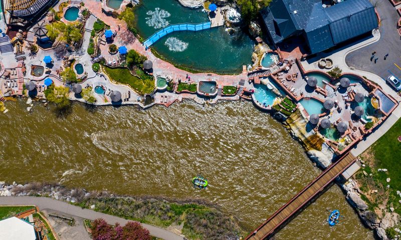
Farther downstream, the San Juan passes Centennial Park, conservation wetlands and community spaces before reaching Yamaguchi Park, where the developed downtown corridor begins giving way to open country.
Below Yamaguchi, roads and buildings disappear from view as the river enters Mesa Canyon. Sandstone mesas, cottonwood galleries, quiet bends and Class II–III rapids define this 13-mile stretch.
After leaving the canyon, the San Juan continues across ranchland, private property and the Southern Ute Indian Reservation. The Piedra River eventually joins the San Juan at Navajo Reservoir and continues into New Mexico.
Within a relatively short distance, the San Juan changes from a mountain headwaters stream into a restored river corridor, downtown whitewater park, geothermal centerpiece and secluded Southwestern canyon.
4. Pagosa Springs’ Downtown Whitewater Park
The San Juan River’s downtown whitewater park concentrates the river’s natural energy into six engineered features that create defined waves, drops, pools, eddies and faster current through the center of Pagosa Springs.
Carefully placed rock structures narrow and shape portions of the channel. Instead of creating isolated attractions disconnected from the river, the features direct the San Juan’s changing seasonal flows into a connected recreation corridor.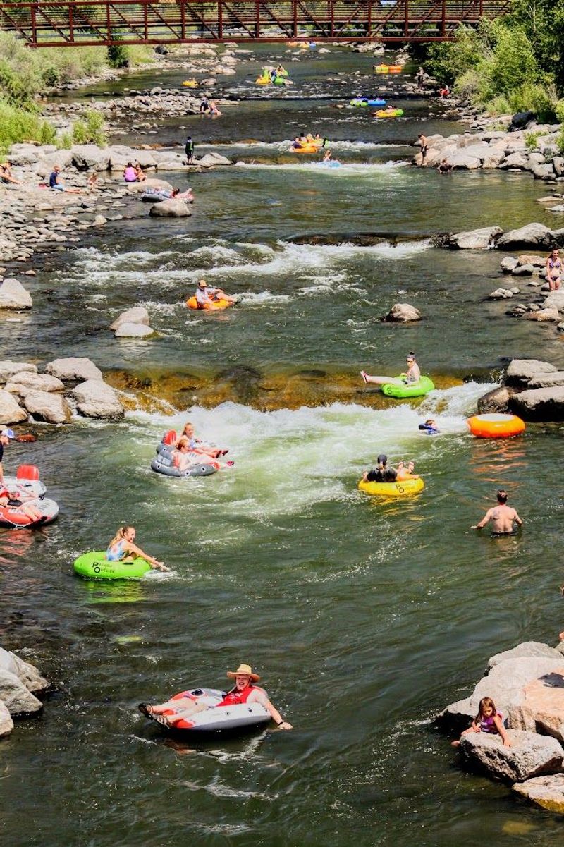
During spring runoff, mountain snowmelt transforms the park into a lively sequence of wave trains, drops and boat-soaking splashes. This section provides the energetic finish to Pagosa Outside’s Splash & Dash rafting trip, combining a scenic introduction with downtown whitewater.
Kayakers use the waves and eddies to practice maneuvers, surf and move between areas of faster and slower water. At favorable flows, experienced river surfers can catch several of the standing waves.
Pagosa Paddle: The Whitewater Park in Motion
Each spring, the Pagosa Paddle turns the downtown whitewater park into a community racecourse. Raft teams, hard-shell kayakers, inflatable kayakers and stand-up paddleboarders compete in sprint, slalom and head-to-head races through the features between Town Park and Centennial Park. A longer downriver race and parade continues to Yamaguchi Park with costumes, unconventional watercraft and plenty of riverside spectators.
The event demonstrates exactly what the downtown structures were designed to support. Waves, eddies, drops and pools become a compact technical course, while the Riverwalk, downtown bridges, Overlook and riverside hot-springs pools provide unusually close spectator viewing. Organized by Friends of the Upper San Juan River, Pagosa Paddle also connects whitewater recreation with local river stewardship and fundraising.
As spring runoff settles, those same features become the drops and rapids that define summer tubing through town. Raft-sized waves become playful tube runs, and the park maintains an active river experience even as the seasonal flow changes.
The action is easy to watch from the Riverwalk, downtown parks and several bridges. Spectators can follow rafts, kayaks, surfers and tubers through the features before continuing to nearby restaurants, shops and hot-springs pools.
The whitewater park makes the San Juan one of downtown Pagosa Springs’ most visible gathering places. The river remains natural and changeable, but its energy is focused into a corridor where people can paddle, float, watch and connect with it.
5. Rafting Season on the San Juan River
Spring snowmelt creates Pagosa’s primary whitewater rafting season. Runoff usually begins building during May, reaches its strongest flows in late May or early June and gradually settles as the mountain snowpack recedes. The timing and intensity vary each year, which is part of the character of rafting a natural, free-flowing river.
What distinguishes rafting in Pagosa Springs is the variety available within one compact local drainage. The San Juan offers three distinctly different experiences rather than three versions of the same trip.
Splash & Dash: Streamlined Downtown Whitewater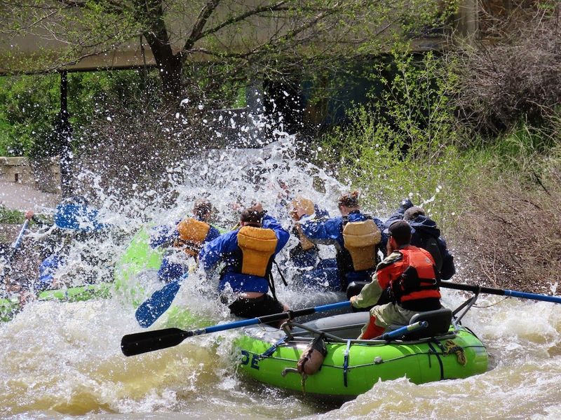 The Splash & Dash is designed to deliver a genuine Pagosa river experience without consuming the entire day.
The trip begins with a scenic float that gives guests time to settle into the boat, learn the paddle commands and enjoy the mountain views. The pace builds as the river enters the downtown whitewater park, where six features create a fast sequence of rolling waves, splashy drops and boat-soaking hits.
It is an excellent introduction for first-time rafters, families and visitors balancing the river with hot springs, hiking or other plans around town. Short on time and big on fun, Splash & Dash is Pagosa’s streamlined quarter-day rafting experience.
Mesa Canyon: Pagosa’s Signature River Journey
Yamaguchi Park marks the transition between Pagosa’s developed river corridor and Mesa Canyon. Below the park, buildings and roads gradually fall away. Cottonwood galleries line the banks, sandstone mesas rise above the river and the sound of town is replaced by moving water and birdlife.
The Mesa Canyon trip follows the San Juan for approximately 13 miles below Pagosa Springs. This is Pagosa’s signature half-day trip and a favorite for families, first-time rafters and anyone looking for meaningful time away from the highway and town.

The San Juan alternates between calm bends and Class II–III rapids. Quiet stretches create time to absorb the landscape, while wave trains and rocky drops bring the group back into the rhythm of paddling. Wildlife becomes easier to notice as the corridor grows more secluded. Near the end of the trip, the channel narrows at Llama Falls, producing the canyon’s largest and most memorable splash. The combination of distance, scenery, whitewater and solitude makes Mesa Canyon feel like a complete river journey rather than a quick ride.
The ability to experience Mesa Canyon depends on downstream access. In 2019, Friends of the Upper San Juan River worked with the Town of Pagosa Springs, Archuleta County and other partners to secure continued public river access. A later community fundraising effort helped improve the takeout and its supporting infrastructure.
That access protects more than a commercial rafting route. It allows private and guided boaters to complete the canyon without trespassing, reduces conflict with neighboring landowners and preserves public connection to one of the upper San Juan’s most scenic reaches.
West Fork: Pagosa’s Premier Technical Adventure
The West Fork reveals an entirely different side of the San Juan drainage.
Pagosa Outside’s private access opens a section with tight boulder gardens, fast technical maneuvers and energetic wave trains. The smaller channel places guests closer to the water and makes teamwork a central part of the experience.
Despite its more technical character, the West Fork can be a strong fit for adventurous first-time rafters as well as experienced paddlers. Professional instruction, premium river gear and small groups preserve the personal character of the trip.
Together, Splash & Dash, Mesa Canyon and the West Fork show how much variety exists within the upper San Juan: concentrated downtown excitement, a long scenic canyon journey and a premium technical mountain run.
6. Tubing Season: Pagosa’s Version of a Beach Day
As spring runoff settles and the river “warms”, Pagosa transitions from rafting season into tubing season. The whitewater park remains active, but its waves and drops become approachable from a completely different perspective: sitting inches above the water in a river tube.
According to Pagosa Springs’ river-use information, the public tubing corridor extends approximately two miles from River Center Park to Yamaguchi Park. Cotton Hole, Town Park, Centennial Park and other downtown access points allow tubers to choose different sections or repeat favorite features.
This is whitewater tubing rather than a lazy-river float. The San Juan carries tubers through current, surf waves, drops and rocky shallows. Flips, spins and swims are part of the fun, and participants should be competent swimmers who are prepared to manage themselves in moving water.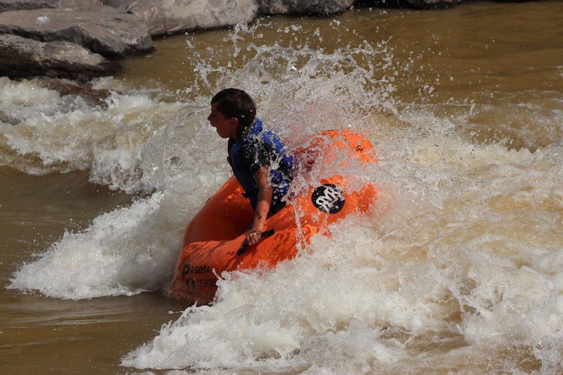
Pagosa Outside offers two ways to experience the river. Tube rentals provide the flexible, self-guided option. Guests can choose their route, walk back along the Riverwalk and make additional laps through favorite sections.
The Deluxe Tubing Trip adds scheduled transportation, premium single and double tubes, life jackets, river shoes, changing rooms, lockers and complimentary digital photos. A route overview helps guests understand the upcoming features while preserving the freedom to float at their own pace.
CRUISE-A-THONg: Pagosa’s Not-So-Serious River Race
Pagosa’s playful relationship with the river is perhaps best captured by CRUISE-A-THONg and the Average Jo(e) Race. The community event combines a cruiser-bike ride along the Riverwalk, a “thong”—meaning flip-flop—walk through downtown and a tube float down the San Juan.
Unlike a traditional triathlon, the goal is not to be fastest. The winner is the participant with the most average finishing time, while costumes, ridiculous flotation devices, comfort-station snacks and creative interpretations of “self-propelled transportation” are part of the competition. The event has produced everything from giant floating flip-flops to an inflatable Noah’s Ark.
Beneath the humor, CRUISE-A-THONg shows how the Riverwalk, public parks, pedestrian connections and downtown tubing corridor work together. It is a distinctly Pagosa celebration: active but approachable, river-centered, family-friendly and unwilling to take itself too seriously.
The Riverwalk makes the experience especially convenient. After reaching a downstream access, tubers can step out of the river and follow the path back toward downtown, the hot springs and Pagosa Outside.
This seasonal transformation is one of the San Juan’s best qualities. The same corridor that carries rafts during runoff becomes Pagosa’s version of a beach day when summer arrives.
7. Hot Springs Beside a Snowmelt River
At the center of Pagosa Springs, two completely different water stories meet along the same riverbank.
The San Juan arrives as cold surface water. Much of it was recently snow resting high in the San Juan Mountains before melting into creeks, joining the East or West Fork and flowing toward town.
Pagosa’s mineral water rises from below. It travels through a deep geothermal system, heated underground before returning to the surface at the Mother Spring and other geothermal outlets.
The river and hot springs are therefore connected by location and community identity rather than by source. One comes down from the mountains; the other rises from deep beneath the earth.
Commercial soaking properties beside the San Juan allow visitors to move between mineral pools of different temperatures while watching the cold river pass below. Informal riverside soaking areas add another expression of Pagosa’s geothermal landscape, with their shape and temperature changing as mineral deposits, river levels and local maintenance evolve.
The Mother Spring anchors the entire story. It supplies geothermal water to the developed soaking pools and has helped make Pagosa Springs a destination for generations. The aquifer has been measured to a depth of at least 1,002 feet without reaching the bottom, reinforcing the sense that the spring’s true depth remains unresolved.
The contrast is especially dramatic in winter, when steam rises beside snow-covered banks. In summer, rafters and tubers pass directly below soaking guests. In every season, the hot springs and San Juan create a setting found in very few mountain towns.
8. Walking the San Juan Riverwalk
The San Juan Riverwalk is the easiest way to understand how thoroughly the river is woven into Pagosa Springs.
The path connects riverside parks, pedestrian bridges, hot springs, wetlands, public art, fishing access and downtown businesses. Visitors can watch whitewater from a bridge, stop for a meal or coffee, explore a park and return to the river without needing to drive between each location.
From Town Park, the Riverwalk passes the hot-springs district and continues toward Centennial Park. This section offers some of the best views of rafts, kayaks, surfers and tubes moving through the downtown features.
Farther downstream, the corridor becomes quieter. Wetlands provide habitat for waterfowl and other birdlife, while slower pools and shaded banks attract anglers. The path continues toward community spaces and Yamaguchi Park at the southern end of the developed river corridor.
Upstream connections lead toward Cotton Hole and River Center, creating access to fishing, tubing and additional park space. Together, these segments allow visitors to experience much of the downtown river without committing to a long hike.
The Riverwalk changes with the seasons. Spring brings fast water and rafting. Summer adds tubers and busy riverbanks. Fall colors the cottonwoods gold, while winter frames the cold river with snow and geothermal steam.
For additional walking and hiking ideas, see our guide to the best hikes near Pagosa Springs.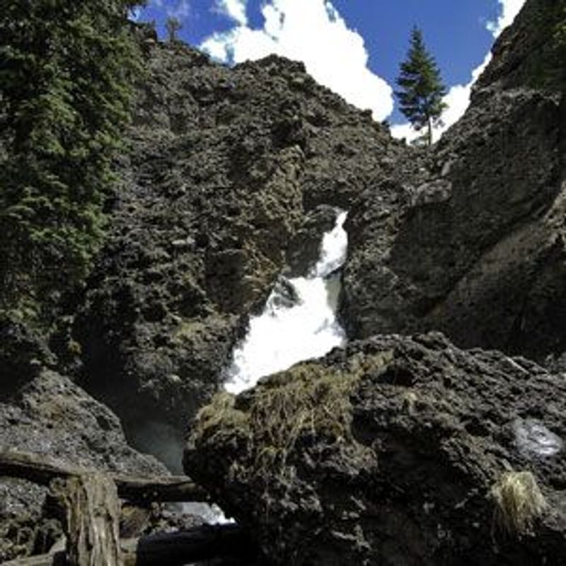
9. Fishing the Upper San Juan: Trout, Native Fish and Connected Habitat
Fishing the upper San Juan is as varied as the river itself. The East and West Forks begin as cold, narrow mountain streams, the main river develops deeper pools and productive riffles as it approaches Pagosa Springs, and the water gradually becomes warmer as it continues toward Mesa Canyon and Navajo Reservoir.
The East and West Forks offer classic high-country trout water, with pocket water, shaded pools and small tributaries fed by snowmelt from the San Juan Mountains. Public sections through and around Pagosa Springs provide convenient access to brown and rainbow trout, while cutthroat trout occur in portions of the surrounding headwaters and backcountry.
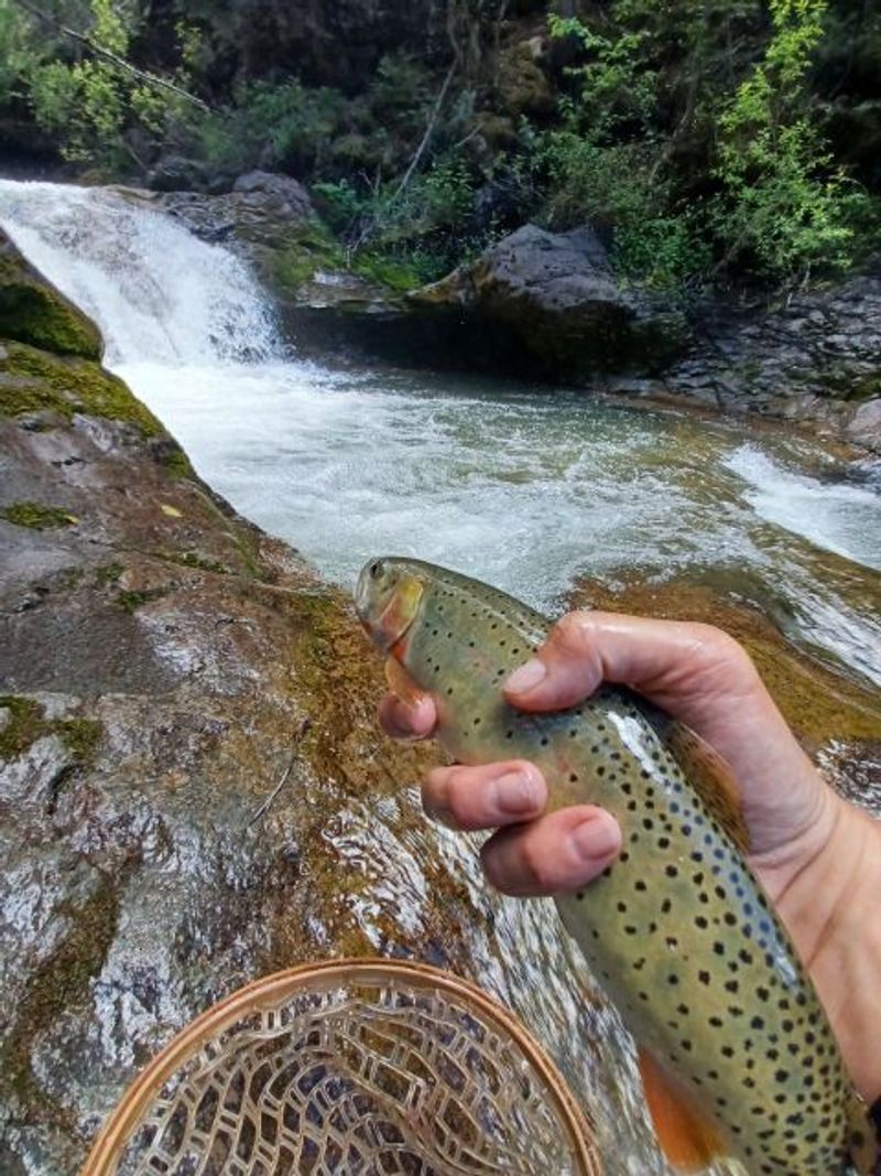
Pagosa’s native-trout story is especially significant. The San Juan lineage of Colorado River cutthroat trout was once believed to have disappeared. Researchers compared preserved trout collected from the San Juan drainage in 1874 with surviving populations hidden in remote headwater streams and confirmed that this distinctive lineage was still alive. Colorado Parks and Wildlife has since developed conservation brood stock and returned San Juan cutthroat trout to protected waters, including streams near the Wolf Creek headwaters.
These rare fish are primarily a conservation priority rather than an everyday angling target. Their survival depends on cold, connected headwater habitat, suitable stream temperatures and carefully managed barriers that prevent nonnative trout from reaching protected populations.
More Than a Trout River
Although most anglers associate Pagosa Springs with trout, the upper San Juan also supports a remarkable community of native warm-water fish. Roundtail chub, flannelmouth sucker and bluehead sucker are found in the San Juan near Pagosa and are protected native species that must be returned to the water immediately if caught.
Each occupies a different part of the river. Roundtail chub favor pools, slower margins, woody cover and areas where they can feed on aquatic insects. Bluehead suckers use specialized mouths to scrape algae from rocks in faster riffles. Flannelmouth suckers can travel considerable distances between feeding, refuge and spawning habitat, making an open and connected river corridor especially important.
These fish are easy to overlook beside the river’s more familiar trout, but they are an important part of the San Juan’s natural history. They evolved in Western rivers long before trout stocking began and help demonstrate how many different habitats can exist within one drainage. Pagosa’s riverfront signs and the official Pagosa Springs fishing brochure provide identification guidance for these protected native species, along with local access information and fishing regulations.
Farther downstream, the San Juan becomes part of an even larger native-fish conservation story. Colorado pikeminnow and razorback sucker are the focus of federal recovery efforts in the warmer lower San Juan, while humpback chub and bonytail are protected elsewhere within the greater Colorado River Basin. These four federally protected species should not be confused with the three native warm-water species anglers may encounter around Pagosa Springs.
Fishing Through Pagosa Springs
Through town, anglers find an unusually accessible mountain-river fishery within walking distance of parks, restaurants, lodging and the Riverwalk. Pools below whitewater features, riffles between engineered structures and shaded banks all create different fishing opportunities as flows change through the year.
Spring runoff brings cold, powerful water and often limits practical fishing. As snowmelt recedes, the river becomes more approachable and its pools, seams and pocket water become easier to read. Summer monsoons can temporarily raise or discolor the river, while autumn frequently brings clear water, cooler temperatures and quieter banks.
Public access is available at designated locations including River Center Park, Cotton Hole, Town Park and Yamaguchi Park. Outside those areas, much of the San Juan and its forks passes through private, Tribal or agricultural land. Seeing the river from a road does not establish permission to cross private property or use its banks, so anglers should enter only from recognized public access points and observe posted boundaries.
Current regulations can differ among downtown Pagosa, surrounding streams, state wildlife areas and Southern Ute Tribal waters. Anglers should consult the official fishing brochure and current agency regulations before heading out.
Why River Habitat Matters
Healthy fishing depends on much more than the number of trout in the river. Deep pools provide refuge during low flows and warm weather. Riffles oxygenate the water and support aquatic insects. Gravel beds create spawning habitat, while cottonwoods, willows and other streamside vegetation stabilize banks, provide shade and drop insects and woody material into the river.
Connectivity is equally important. Fish need to move between spawning areas, feeding water and seasonal refuges as flows and temperatures change. Thoughtfully designed diversion structures, restored banks and improved fish passage can support native fish while continuing to serve agricultural water users and recreational boaters.
That is why river-restoration work around Pagosa Springs benefits the entire aquatic community. Better pools, stable banks, functioning riffles, cooler shaded margins and improved passage support stocked trout, wild trout and the San Juan’s less-visible native fishes. The result is a healthier river—and a much richer fishing story than a simple list of places to cast a line.
10. Public River Access: What Makes Recreation Possible
A river flowing through the center of town can appear completely public. In reality, every rafting trip, tubing lap, fishing afternoon and Riverwalk stroll depends on a connected system of parks, easements, trails, boat ramps, private agreements and carefully located entry and exit points.
Pagosa Springs has built that system gradually. It now extends from developing access at the eastern entrance to town, through the downtown parks and whitewater corridor, into Yamaguchi Park and eventually to the public Mesa Canyon takeout 13 miles downstream. Two major projects—East Gateway River Park and Yamaguchi South—are expanding that connection at both ends.
Why River Access Is Complicated in Colorado
Colorado’s rivers are public water resources, but that does not mean every riverbank or riverbed is open to public recreation. Along many Colorado streams, adjoining property owners own the banks and the underlying riverbed. The public therefore cannot assume it has permission to enter from private land, walk along a private bank, wade across a privately owned riverbed, stop for lunch or climb out wherever it is convenient.
The right merely to float through private property is more complicated. The 1979 Colorado Supreme Court decision People v. Emmert found that the public does not have an automatic right to float through private property on a non-navigable stream without the landowner’s permission. A 1983 Colorado attorney general’s advisory opinion later concluded that floating without touching the bed or banks would not constitute criminal trespass, but that opinion was not binding law and did not resolve potential civil claims. Colorado’s nonpartisan Legislative Council summarizes that unsettled history in its official River Access in Colorado issue brief.
For visitors, the practical rule is much simpler: use designated public access points, respect signs and fences, and never assume that floating water makes the surrounding land or riverbed public. Avoid anchoring, standing, wading or stopping along a privately owned reach without permission.
That respect is especially important in the upper San Juan, where ranches and other private properties have protected long stretches of riverbank, wildlife habitat and agricultural open space. Many also maintain irrigation systems, control invasive vegetation and invest directly in the health of the river corridor. Lasting recreational access works best when it is planned cooperatively rather than assumed.
East Gateway River Park: Filling an Important Upstream Gap
Despite the San Juan’s importance to Pagosa Springs, there is currently no purpose-built public rafting access upstream from town. Commercial trips that begin above downtown depend on permission, easements or agreements with private landowners. Members of the general public do not have an established upstream launch where they can conveniently unload and launch a full-size raft. That missing access is one reason the developing East Gateway River Park is so important.
The Town of Pagosa Springs purchased the approximately 4.3-acre former commercial property at 1040 East Highway 160 in 2025. Its location beside the river creates an opportunity to establish a genuine upstream public boat launch while restoring a previously developed property and making the eastern entrance to Pagosa more welcoming.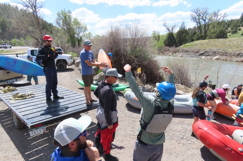
Plans are being developed in phases. Initial work includes clearing old structures, cleaning the property, establishing boat access and making basic parking and landscape improvements. Future concepts include restrooms, changing areas, shade structures, wetlands, educational signs, an accessible fishing pier and a Riverwalk trailhead connecting with existing paved trails.
A functional upstream launch would do more than add another park. It could fill one of the largest gaps in Pagosa’s public river infrastructure, create a legitimate starting point for private boaters and reduce the temptation to use informal or private access. It could also improve emergency access and provide a stronger upstream connection between the river, Riverwalk and downtown.
East Gateway River Park should not be confused with the completed Pagosa Gateway restoration project farther upstream. The restoration project concentrated on channel function, fish habitat, bank stability and native vegetation. The new park is focused on public access and recreation, although the two projects complement one another as parts of the same improving river corridor.
River Center, Cotton Hole and Downtown Pagosa Springs
Moving downstream, River Center Park and Cotton Hole Park provide established public access before the river reaches the busiest part of downtown. Town Park, Centennial Park and the Riverwalk then connect visitors with Pagosa’s whitewater features, pedestrian bridges, fishing water and geothermal springs.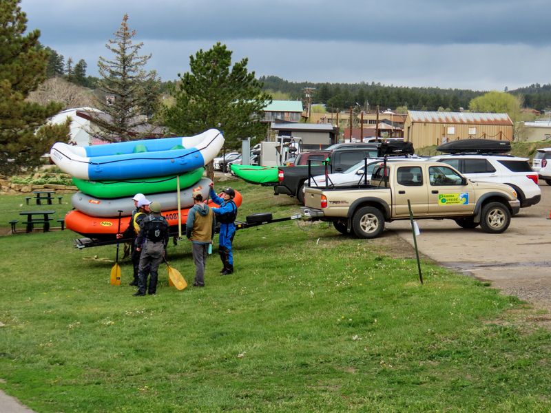
This central corridor makes Pagosa’s river unusually approachable. Visitors can enter and exit at designated locations, watch rafting and kayaking from downtown bridges, fish from public parks or follow the river on foot without crossing private property.
These developed access points also concentrate use in places designed to accommodate it. That protects more sensitive banks, reduces conflicts with neighboring property owners and makes parking, sanitation, maintenance and emergency response more manageable.
Yamaguchi South: Extending the Public Corridor
Yamaguchi Park currently anchors the southern end of Pagosa’s downtown river corridor. The Yamaguchi South River Improvement Project, now advancing through construction in 2026, will extend that endpoint farther downstream while improving both recreation and river habitat.
The project continues approximately 1,700 feet below the existing river access and includes a new downstream boat ramp and parking area, additional approaches to the water, improved pools and riffles, bank stabilization, wetland and pond enhancements and upgraded irrigation infrastructure for the park. Dead or declining cottonwoods can be repurposed as underwater fish habitat, while transplanted willows and other vegetation will help stabilize disturbed banks.
For boaters and tubers, the new takeout will create a longer in-river experience and a more functional place to exit. Anglers will gain better access to more varied water, while fish benefit from deeper pools, productive riffles, shade, cover and improved habitat connectivity.
Yamaguchi South is particularly valuable because it does not treat access, recreation, irrigation and ecological restoration as separate problems. Each improvement is designed as part of the same working river corridor.
Mesa Canyon: Why a Legal Takeout Matters
Below Yamaguchi Park, the San Juan enters the 13-mile Mesa Canyon reach. Roads and buildings disappear, sandstone mesas rise above the river and public access becomes extremely limited.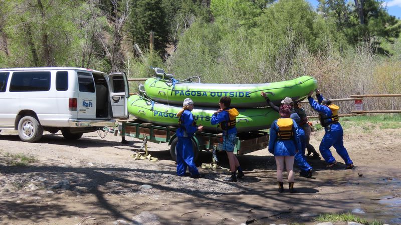
The public Mesa Canyon takeout makes this entire journey possible. Before it was secured, boaters could travel through the canyon but lacked an appropriate legal place to leave the river. A community effort involving Friends of the Upper San Juan River, the Town of Pagosa Springs, Archuleta County, outfitters, donors and other partners raised more than $90,000 and turned a vulnerable access point into a lasting public resource.
The takeout may appear to be a simple ramp and parking area, but its legal importance is much greater. Without a recognized place to exit, the canyon would be effectively unavailable to most private and commercial trips regardless of how much water flowed through it.
Mesa Canyon demonstrates why river access must exist at both ends of a trip. A beautiful stretch of water is not genuinely accessible if boaters have nowhere lawful and practical to launch or land.
Access Depends on Cooperation
Successful river access rarely comes from one organization. Town and county governments, conservation groups, landowners, outfitters, anglers, paddlers, water users, funding agencies and neighboring residents often bring different priorities to the same project.
The best access projects recognize that private-property rights, agriculture, wildlife habitat and recreation all share the corridor. Clearly designated launches and takeouts give the public practical ways to enjoy the river while reducing trespass, informal trails, damaged banks and conflict with landowners.
That work becomes largely invisible once a trail, ramp or park opens. Yet Pagosa’s evolving river corridor—from the much-needed upstream launch at East Gateway through downtown and Yamaguchi South to the Mesa Canyon takeout—exists because people repeatedly recognized that access was worth planning, negotiating, funding and protecting.
The San Juan may have carved the valley, but cooperation is what allows the public to experience it.
11. Floods Are Part of the River’s Story
The San Juan is a free-flowing mountain river, and change is one of its defining characteristics.
Winter snowpack determines much of the spring runoff. Warm temperatures influence when that water arrives. Summer monsoons can create short-lived rises, while prolonged rainfall can saturate the watershed and produce much larger events.
The river also carries sediment, trees, branches and stone. Banks erode, gravel bars move, pools fill and channels shift. These processes can create new habitat in one location while damaging infrastructure or eliminating access somewhere else.
The October 2025 floods provided a modern example of how quickly the San Juan can reshape its corridor. The floods moved debris, altered banks and changed sections of the river in ways Pagosa Springs had not experienced in decades.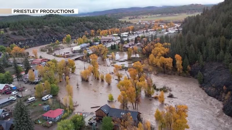
For the complete account of those floods, the recovery work and the major projects that followed, read our Pagosa Springs San Juan River flood-recovery update.
Flood recovery is an important chapter, but it is part of a much longer story. The San Juan has always responded to snow, rain, sediment and gravity—and it will continue to do so.
12. Forest Health Is Water Infrastructure
The San Juan River does not begin at the edge of its channel. It begins across an entire mountain landscape of snowfields, forests, wetlands, groundwater, soils and small tributaries. Protecting the river therefore requires looking uphill.
Healthy forests influence how snow accumulates, how quickly it melts and how much sediment reaches nearby streams. Roots and ground cover hold mountain soils in place, while streamside vegetation shades the water and helps stabilize banks.
Wetlands add another layer to that natural water system. High-mountain wetlands spread water across valley bottoms, reduce its speed, capture sediment and create habitat for birds, amphibians, insects and other wildlife. Their saturated soils also connect surface water with shallow groundwater and can influence when water reaches downstream channels.
Fens are an especially valuable form of mountain wetland. Unlike wetlands supplied mainly by seasonal runoff, fens are fed by groundwater and accumulate layers of peat over centuries or even thousands of years. They support specialized plant communities, retain water within the high country and provide steady sources of cold water within mountain landscapes. Once severely damaged, a mature fen cannot simply be rebuilt on a construction schedule.
These wetlands are sometimes described as natural sponges, although their function is more complicated than absorbing spring runoff and releasing it later. Their greater value comes from storing water within the landscape, supporting groundwater connections, filtering sediment, maintaining habitat and helping headwater ecosystems remain resilient through dry periods.
Wildfire is a natural part of this landscape, but severe fire across an unhealthy forest can transform the watershed in a matter of hours. Once vegetation and ground cover are lost, heavy rain can move ash, soil, rocks and woody debris into streams. Those flows can affect drinking-water infrastructure, fill pools, damage fish habitat, block culverts and reshape downstream channels.
Forest management does not produce one simple or guaranteed water result. Thinning, prescribed fire, wetland restoration, stream improvements and other treatments have different effects depending on forest type, terrain, weather and project design. Their broader purpose is to create a landscape better able to experience fire, drought and changing snowpack without producing the most damaging consequences for communities and waterways.
The San Juan Headwaters Forest Health Partnership has worked on this connection since 2009. The partnership brings together conservation groups, governments, federal agencies, scientists, ranchers, Tribal and private-land interests, recreation representatives, businesses and local residents.
Its work includes identifying priority landscapes, developing science-based forest treatments, securing project funding and monitoring results. That monitoring matters: watershed stewardship should be based on what treatments accomplish on the ground, not simply on how many acres appear in a project report.
The partnership also works across ownership boundaries. Water, wildfire and sediment do not stop when they reach a fence or move from national forest onto private or Tribal land. Meaningful headwaters protection requires neighboring land managers and communities to work at the scale of the landscape.
For Pagosa Springs, forests, wetlands and fens are not separate environmental features located somewhere beyond town. They are part of the community’s natural water infrastructure. They influence the water entering municipal diversions, the habitat supporting trout, the runoff carrying rafts and the San Juan flowing past the hot springs.
13. Building a Healthier River Corridor
Pagosa’s major river projects reflect a growing understanding that restoration, recreation and public access work best when planned together.
The Pagosa Gateway Project addresses approximately two miles of river upstream from town. Its goals include deeper pools, improved low-water connectivity, aquatic habitat, stabilized banks, debris removal, native vegetation and a more resilient river corridor. Major construction is substantially complete, followed by vegetation work and long-term monitoring.
The Yamaguchi South River Improvement Project extends that approach downstream. Planned work includes improved fish habitat, sediment movement, irrigation infrastructure, recreation features and a new river access designed to extend the in-river experience another 1,700 feet. The project is scheduled to begin toward the end of summer 2026, with the Town’s project page providing current updates.
The East Gateway River Park creates a longer-term opportunity to expand public access and reconnect the upstream river corridor with Pagosa Springs. Thoughtful development could eventually bring habitat restoration, trails and river access together at the eastern entrance to town.
The Mesa Canyon Takeout demonstrates what these partnerships can accomplish. Community fundraising and collaboration protected access to the canyon while creating an appropriate location for boaters to leave the river.
Better pools support fish. Stable banks protect habitat and infrastructure. Native vegetation provides shade and wildlife cover. Defined access reduces damage to sensitive areas. Well-designed whitewater and boating features create recreation while helping guide flow through the channel.
The strongest river projects do not force a choice between ecology and recreation. They recognize that a functioning river corridor benefits fish, wildlife, boaters, anglers, walkers, landowners and the wider community.
14. From Snowfield to Faucet and Field: Municipal and Agricultural Diversions
The San Juan is a recreational river, but it is also working water. Before reaching Pagosa’s whitewater park—or continuing downstream toward ranches, Tribal lands and Navajo Reservoir—some of its flow is diverted, stored and distributed for homes, businesses and agriculture.
From the Headwaters to Pagosa’s Faucets
Pagosa’s municipal system begins with surface water from the upper San Juan watershed. According to the Pagosa Area Water and Sanitation District, its principal raw-water sources include the West Fork of the San Juan River, the San Juan River main stem and Fourmile Creek through the Dutton Pipeline.
From those sources, water travels through approximately 20 miles of raw-water pipelines before reaching reservoirs or treatment facilities. The Snowball Water Treatment Plant receives water from the West Fork system. The Hatcher plant treats water stored in Hatcher Reservoir, while the San Juan plant can treat water taken from the main river or Lake Forest.
The lakes throughout the Pagosa Lakes area are therefore more than neighborhood scenery. Hatcher Reservoir, Stevens Reservoir, Lake Pagosa, Village Lake and Lake Forest form parts of an interconnected storage and delivery system supplied in large part by Fourmile Creek. The system collects water when it is legally and physically available, stores it and moves it among treatment facilities as community demand changes.
Water flowing from a Pagosa faucet may consequently have followed a surprisingly complicated route. It could have begun as snow near the West Fork, passed through a diversion and pipeline to Snowball, or melted in the Fourmile drainage before traveling through the Dutton system and a chain of reservoirs west of town.
The South San Juans water-system infographic provides an excellent visual introduction to the relationship among the mountains, diversions, reservoirs, treatment plants and community water system.
Agriculture Is Pagosa’s Largest Water Use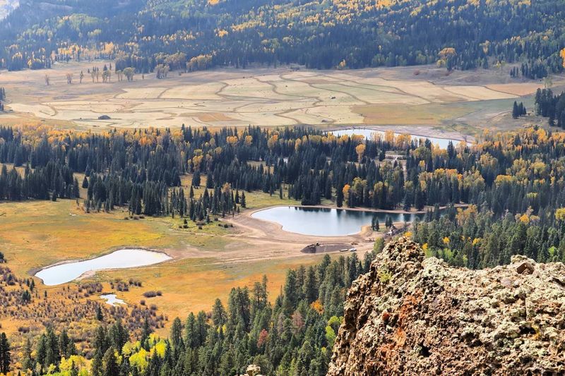
Municipal water is only one part of the local story. Ranches and agricultural properties throughout the upper San Juan watershed rely on ditches, headgates and smaller distribution systems that move river and tributary water onto fields and pastures.
During irrigation season, a headgate directs part of a stream into a ditch. Gravity can then carry that water across the landscape for miles before it reaches the land where it is used. These systems support hay production, livestock operations, open space and a ranching tradition that remains central to Archuleta County.
A 2015 USGS county water-use estimate helps place the scale in perspective. Irrigation withdrawals in Archuleta County averaged approximately 41.95 million gallons per day—the equivalent of about 65 cubic feet per second, 15.3 billion gallons or 47,000 acre-feet over a year. Public-water supplies averaged approximately 2.44 million gallons per day, equivalent to about 3.8 cfs.
Based on those estimates, irrigation accounted for roughly 94 percent of the county’s total water withdrawals. Public supply represented approximately 5.5 percent, with livestock, commercial, industrial and other uses comprising the small remainder.
Those figures describe estimated withdrawals, not a sum of decreed water rights. The distinction matters. Colorado water rights may be absolute or conditional, can authorize several uses and do not guarantee that the entire decreed amount will be physically available or diverted. Adding every right listed for irrigation, municipal use and storage would double-count some water and create a misleading total.
Park Ditch: The River’s Route Around Downtown
One of the clearest examples of the San Juan serving agriculture is the Park Ditch. Its headgate diverts water from the river upstream of downtown and carries it east toward ranchlands in the Mill Creek drainage.
Park Ditch holds historical irrigation rights totaling as much as 60 cfs. At that full decreed rate, the ditch could carry nearly 39 million gallons per day. Actual diversions vary with river flow, irrigation demand, water-right priority and ditch operations.
Park Ditch helps explain why the flow reaching downtown can be lower than the amount descending from the headwaters. During irrigation season, part of the San Juan can leave the main channel upstream of town and travel east through the ditch system.
A diversion is not the same as complete consumption. Some water is used by crops or lost through evaporation. Some seeps into the ground, supports vegetation or eventually returns through shallow groundwater, tailwater and drainage channels. Portions of the Park Ditch system’s return water reach Mill Creek, which joins the San Juan approximately a mile below downtown.
The water therefore does not all disappear from the watershed, but it can bypass the downtown river corridor and return at a different location and time. This is one reason the number recorded at a stream gauge represents only one moment and location within a much larger moving system.
Helping Historic Irrigation Systems Work Better
Many of Pagosa’s irrigation ditches were built generations ago. Aging headgates, diversion boxes, culverts, measuring structures and earthen channels can make water difficult to control and expensive for small ditch companies and individual ranchers to maintain.
The Upper San Juan Watershed Enhancement Partnership works with agricultural producers, ditch representatives and conservation partners to identify practical improvements. Its role is collaborative: document existing conditions, help establish priorities, connect landowners with technical expertise and develop voluntary projects that may qualify for outside funding.
Working with the San Juan Conservation District and receiving technical assistance from the Natural Resources Conservation Service, WEP completed one of the most detailed inventories of local irrigation infrastructure ever assembled. The team evaluated approximately 71.4 miles of ditch, 508 structures, 160 irrigators, 322 fields and 5,374 irrigated acres.
The assessment found that approximately 4,664 acres used traditional ditch or surface irrigation, with an estimated application efficiency of 30 to 50 percent. Another 683 acres used gated pipe, estimated at 50 to 60 percent efficiency, while 27 acres used sprinkler systems, estimated at 70 to 75 percent efficiency. The complete Phase II assessment identified approximately $8.8 million in potential ditch and on-farm improvements.
Depending on the location and operation, those improvements could include repairing headgates, replacing failing culverts, installing accurate measuring structures, stabilizing problem ditch segments, adding gated pipe or using properly designed sprinkler systems where the terrain and agricultural operation make them practical.
Greater efficiency does not automatically mean enclosing every ditch or replacing every traditional method. Seepage from earthen ditches can support groundwater, wetlands and established vegetation, while irrigation return flows may supply downstream channels and water users. A project that reduces one diversion can also change when and where water returns to the system.
The strongest projects examine the entire water path. The goal is to help ranchers reliably deliver the water available under their rights while reducing avoidable operational losses and accounting for return flows, habitat and downstream users.
Agriculture, municipal supply, fish habitat and recreation all depend on the same seasonal runoff. Understanding how that water moves—and helping old infrastructure perform more reliably—creates opportunities to support working ranches and a healthier river at the same time.
For anglers and boaters, these withdrawals help explain why river flow can change between two locations even when the weather has remained constant. Tributaries add water, diversions remove it and return flows may reenter later. The number recorded at one stream gauge is therefore only a snapshot of a much larger moving system.
Agriculture, municipal supply, fish habitat and recreation all depend on the same finite seasonal runoff. Understanding those connections is more useful than treating each water use as if it belonged to a different river.
15. Future Water Storage and the Running Iron Ranch Proposal
The question of whether Pagosa’s existing water system can meet future needs has led to one of the area’s most consequential—and debated—water proposals.
The San Juan Water Conservancy District is pursuing planning for an off-stream reservoir at Running Iron Ranch northeast of Pagosa Springs. Known as the San Juan Headwaters Project, the proposed reservoir could store up to approximately 11,000 acre-feet of water, equivalent to nearly 3.6 billion gallons.
An off-stream reservoir differs from a traditional dam built directly across a river. Rather than blocking the San Juan itself, the proposed facility would occupy a separate basin and be filled by diverting water when river flows, water rights and operating conditions allow.
Park Ditch provides an important physical connection between the San Juan and the proposed reservoir site. Current conditional water rights contemplate filling the reservoir using Park Ditch, a proposed pumping station and runoff originating within the reservoir basin.
According to the San Juan Water Conservancy District’s water-rights tabulation, those proposed filling sources would share a combined limit of 50 cfs under the project’s 2004 storage right. Diversions would also be subject to senior water rights, annual and decennial storage limits and required bypass flows at the Pagosa Springs gauge.
The project’s 50 cfs filling limit and Park Ditch’s historical 60 cfs irrigation rights should not be added together as though 110 cfs would automatically bypass downtown. They are different, partly overlapping water-right and conveyance arrangements with separate priorities, conditions and uses.
The stated purpose of the project is to preserve local water rights and create additional storage for possible future community needs, drought resilience and changing runoff patterns. The Colorado Water Conservation Board, Pagosa Area Water and Sanitation District and San Juan Water Conservancy District have all held interests in the Running Iron Ranch property and its associated planning effort.
The proposal remains in the study and planning process. In 2026, SJWCD reported that an initial feasibility submission to the Bureau of Reclamation did not receive approval and that additional work—potentially including updated supply-and-demand analysis—would be needed before the project could advance.
Supporters view storage as a way to capture water during periods of availability and hold it for dry years or future growth. Questions surrounding the proposal include demonstrated demand, construction and operating costs, financing, evaporation, environmental effects, diversion timing and how stored water would interact with streamflow, recreation and existing agricultural uses.
Those are legitimate public-policy questions. The answers will depend on engineering, updated demand projections, environmental review, water-court requirements, financing and community priorities. At this stage, the most accurate description is neither that the reservoir is unquestionably necessary nor that it is inherently harmful. It is a major proposed water project whose potential benefits, costs and tradeoffs are still being evaluated.
Readers can follow the San Juan Water Conservancy District’s project information and FAQs as studies and public discussions continue.
16. The Surprising Journey Beneath the Continental Divide
Most water falling as snow on the western side of the Continental Divide follows gravity toward the San Juan River, the Colorado River and eventually the Pacific watershed. Near Pagosa Springs, however, some of that water takes a very different route.
The San Juan–Chama Project collects water from three upper San Juan tributaries: the Rio Blanco, Little Navajo River and Navajo River. Diversion structures direct the water into a system of conduits, siphons and approximately 26 miles of tunnels.
Instead of continuing downstream through the San Juan and Colorado River systems, the water travels beneath the Continental Divide and emerges in the Rio Chama watershed. From there, it reaches Heron Reservoir and eventually contributes to the Rio Grande system.
The Bureau of Reclamation reports that the project diverted an average of approximately 89,800 acre-feet annually between 1991 and 2020. One acre-foot contains about 325,851 gallons, making that average equal to roughly 29.3 billion gallons per year.
A full annual project allocation of 96,200 acre-feet equals approximately 31.3 billion gallons.
The water helps serve Albuquerque, Santa Fe, the Middle Rio Grande Conservancy District, Tribal communities and other users within the Rio Grande Basin. Although the diversion facilities are located in and near Colorado, the project uses a portion of New Mexico’s allocation from the Colorado River system under the governing interstate compacts.
The Smaller Diversion at Wolf Creek Pass
The San Juan–Chama Project is the region’s largest transbasin water story, but it is not the only place where San Juan Basin water crosses the Continental Divide.
Near Wolf Creek Pass, the much smaller Treasure Pass Diversion Ditch—sometimes described locally as the Rio Grande diversion ditch—collects water from tributaries of Wolf Creek. Wolf Creek is part of the West Fork of the San Juan drainage, which would naturally carry that water toward Pagosa Springs.
The ditch instead moves the water across the Continental Divide into a tributary of the South Fork Rio Grande. Unlike the San Juan–Chama Project’s long system of tunnels, this older diversion uses a comparatively simple high-elevation ditch to move water from one watershed into another.
Its scale is tiny beside the tens of billions of gallons associated with San Juan–Chama, but the principle is the same: water beginning on the San Juan side of the mountains is redirected into the Rio Grande Basin.
Together, the two diversions reveal how complicated a mountain watershed can be. Snow falling near Pagosa may flow naturally through town, cross the Divide through a small ditch at Wolf Creek Pass or enter a tunnel system that carries it beneath the mountains toward the Rio Chama.
Gravity begins the journey, but Western water engineering sometimes changes the destination.
17. Local Stewardship: The Work Behind the River
The San Juan River visitors enjoy today reflects decades of planning, fundraising, construction, negotiation, observation and volunteer work.
Friends of the Upper San Juan River has supported whitewater features, park improvements, river cleanups, community events and the effort to preserve public access to Mesa Canyon. FUSJ also brings people into the stewardship story through events such as Pagosa Paddle and CRUISE-A-THONg. One showcases the technical possibilities of the downtown whitewater park; the other celebrates the Riverwalk and summer tubing corridor with unapologetically average athleticism. Both help turn the San Juan from scenery passing through town into a shared community resource worth supporting.
The Upper San Juan Watershed Enhancement Partnership brings agricultural producers, agencies, conservation groups, water organizations, recreation representatives and community members together around shared watershed priorities. Its work now reaches from downtown river restoration to the modernization of agricultural infrastructure.
The San Juan Headwaters Forest Health Partnership extends that stewardship into the landscape where the river begins. By coordinating science, forest treatments, monitoring and community participation across public, private and Tribal lands, the partnership connects wildfire resilience, forest health, wetlands and water quality with the long-term future of the upper San Juan.
The Town of Pagosa Springs and Archuleta County maintain parks, trails, infrastructure and public access while helping coordinate larger restoration and recovery projects. The San Juan Water Conservancy District contributes water knowledge and long-term planning. Trout Unlimited and Colorado Parks and Wildlife bring fisheries, habitat and biological expertise.
Local landowners remain essential. Much of the river outside downtown passes through private property, ranchland or Tribal lands. Continued recreation and restoration depend on relationships that respect those boundaries and recognize the responsibilities carried by the people who live and work beside the river.
Pagosa Outside has contributed years of volunteer stakeholder work, on-water observations, landowner relationships and river-design feedback to these community efforts. That involvement gives us an unusual perspective: we experience the river as a recreation business, but also as local residents who have watched its channels, access points and seasonal flows change over time.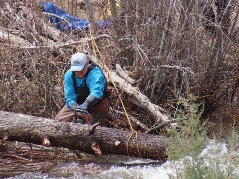
Outfitters, anglers, paddlers and volunteers contribute another form of knowledge. They observe the river at different flows, notice changes in channels and access, remove trash, report problems and help visitors understand how to use the corridor responsibly.
No single organization created Pagosa’s river experience. It has grown through cooperation among people who fish it, float it, manage it, study it, restore it, irrigate from it and live beside it.
That work is why the San Juan can function as a mountain watershed, community water supply, working agricultural river, downtown gathering place, recreation corridor and living ecosystem at the same time.
18. One River, the Story of Pagosa Springs
The San Juan River is more than a feature running through Pagosa Springs. It is the thread connecting the community’s headwaters, downtown parks, whitewater, hot springs, fishing water, restoration projects and canyon country.
Few places allow visitors to experience so many expressions of one river within such a compact area. You can watch snowmelt become whitewater, follow the Riverwalk between parks and geothermal pools, float through downtown and then travel downstream until the buildings disappear beneath sandstone mesas.
The river also reveals a larger story about water in the Southwest. Its natural flows respond to snowpack, weather and floods, while restoration projects, public-access partnerships and transbasin diversions demonstrate how closely water, people and landscapes are connected.
The best way to understand the San Juan is to spend time beside it—and, when the season is right, on it. Walk the Riverwalk, watch the waves from a downtown bridge, explore the headwaters and experience the river through rafting or tubing with Pagosa Outside.
From its first miles beneath the Continental Divide to the quiet bends of Mesa Canyon, the San Juan is not simply part of Pagosa Springs. It is the river that makes Pagosa what it is.
19. Frequently Asked Questions About the San Juan River in Pagosa Springs
Where does the San Juan River begin?
The San Juan River officially begins northeast of Pagosa Springs, where the snow-fed East and West Forks meet after gathering water from the high San Juan Mountains near the Continental Divide.
What is the difference between the San Juan River and its East and West Forks?
The East Fork and West Fork are separate mountain headwater branches. The main San Juan River begins where those two forks join and then flows southwest through Pagosa Springs.
Does the San Juan River flow through downtown Pagosa Springs?
Yes. The San Juan passes directly through downtown Pagosa Springs alongside public parks, the Riverwalk, geothermal soaking pools and six engineered whitewater features.
What can visitors do on the San Juan River in Pagosa Springs?
Depending on the season and river level, visitors can enjoy whitewater rafting, river tubing, kayaking, river surfing, fishing, wildlife watching and walking along the Riverwalk.
When is rafting season in Pagosa Springs?
Pagosa’s normal rafting season is during spring snowmelt, typically from May into June. Runoff often reaches its strongest flows in late May or early June before gradually transitioning toward summer tubing conditions.
What rafting trips are available on the San Juan River?
Pagosa Outside offers three distinct experiences within the upper San Juan drainage: the streamlined Splash & Dash through downtown whitewater, the signature 13-mile Mesa Canyon river journey and the premier West Fork technical adventure.
When is tubing season in Pagosa Springs?
Tubing generally begins after spring runoff settles into lower summer flows. The exact transition varies with snowpack, temperature and rainfall because the San Juan is a natural, free-flowing river.
Is tubing in Pagosa Springs a lazy-river float?
No. Pagosa offers genuine whitewater tubing through moving current, surf waves, rocky shallows and downtown drops. Tubers should be competent swimmers, prepared for flips and comfortable managing themselves in moving water.
How long is the public tubing corridor?
Pagosa Springs identifies approximately two and a half miles of public river between the East Gateway River Park and Yamaguchi South Park. Visitors can use designated access points at Cotton Hole, Town Park, Centennial Park and other locations along the corridor. See the Town’s San Juan River-use information before floating.
What is the Pagosa Springs whitewater park?
The downtown whitewater park is a series of six engineered river features. Carefully placed rock structures concentrate the San Juan’s energy into waves, drops, pools and eddies used for rafting, kayaking, river surfing, tubing, swimming and community paddling events.
Are Pagosa’s hot springs part of the San Juan River?
The hot springs and river are separate water systems. The San Juan carries cold snowmelt from the mountains, while Pagosa’s mineral water rises from a deep geothermal aquifer. The two meet visually along the downtown riverbank.
Can you walk along the San Juan River?
Yes. The San Juan Riverwalk connects downtown parks, pedestrian bridges, hot springs, wetlands, fishing and tubing access, whitewater viewing and local businesses. It is also featured in our guide to the best hikes and walks near Pagosa Springs.
Can you fish the San Juan River in Pagosa Springs?
Yes. Designated public sections through and around town provide access to trout water, while the East and West Forks and high-country tributaries offer additional opportunities. Anglers should check current Colorado regulations and remember that being able to see the river does not make private banks or riverbed public.
What is Mesa Canyon?
Mesa Canyon is the secluded 13-mile stretch of the San Juan River below Pagosa Springs. Sandstone mesas, cottonwood-lined bends, wildlife, Class II–III rapids and Llama Falls make it Pagosa’s signature longer river journey.
Is the entire San Juan River publicly accessible?
No. Downtown parks and designated access points provide a connected public corridor, but many reaches outside town pass through private, Tribal or agricultural land. Floating through a corridor and using its banks are different, so visitors should enter and exit only at established public locations.
Where does Pagosa Springs’ drinking water come from?
The Pagosa Area Water and Sanitation District receives raw surface water from the West Fork of the San Juan, the San Juan River main stem and Fourmile Creek through the Dutton Pipeline. Pipelines, reservoirs and treatment plants store, treat and distribute that water throughout the community.
What is the proposed Running Iron Ranch reservoir?
The San Juan Water Conservancy District is studying an off-stream reservoir known as the San Juan Headwaters Project. The proposal could store up to approximately 11,000 acre-feet—or nearly 3.6 billion gallons—for possible future community needs. Its demand, cost, environmental effects, financing and operating details remain part of the ongoing reservoir-planning process.
What is the San Juan–Chama Project?
The San Juan–Chama Project diverts water from the Rio Blanco, Little Navajo and Navajo rivers through conduits, siphons and approximately 26 miles of tunnels beneath the Continental Divide. The project has transferred an average of roughly 29.3 billion gallons annually into the Rio Chama and Rio Grande systems.
How do floods and forest health affect the San Juan River?
Snowpack, wildfire, rainfall, erosion, sediment and woody debris can all change the river’s flow, water quality and channel. Healthy forests and resilient streamside vegetation help protect soils and waterways, while major floods can quickly move banks, gravel bars and debris. Read the complete San Juan River flood-recovery update for the story of the October 2025 floods.
Where does the San Juan River go after leaving Pagosa Springs?
Below town, the San Juan flows through Mesa Canyon, crosses the Southern Ute Reservation and enters Navajo Reservoir. It continues through New Mexico and Utah before joining the Colorado River at Lake Powell, nearly 400 miles from its source.